GPSMAP 66sr Multi-Band/GNSS Handheld with Sensors and TOPO Maps
Take 10% Off Your Next Order!
Join the team that's driving innovation. When you sign-up to receive updates in your inbox on our Field Notes, Flash Sales, New Arrivals, & more, we’ll send you a code for 10% off your next order!
Product Description
- Large 3” sunlight-readable color display for easy viewing
- Expanded global navigation satellite systems (GNSS) and multi-band technology allow you to get optimal accuracy in challenging locations, including steep country, urban canyons and forests with dense trees
- Powered by internal Li-ion rechargeable battery, with up to 36 hours battery life in Standard Mode and up to 450 hours in Expedition Mode.
- Access to BirdsEye Satellite Imagery with direct downloads and no annual subscription plus routable TopoActive mapping and federal public land map (U.S. only)
- Go-anywhere navigation with 3-axis compass and barometric altimeter
- Expanded wireless connectivity supports Active Weather for up-to-date forecasts and animated weather radar and Geocaching Live for mobile syncing and updates
- Compatible with the Garmin Explore™ website and app1 to help you manage tracks, routes and waypoints and review statistics from the field
1Requires compatible smartphone (sold separately)

Know the way.
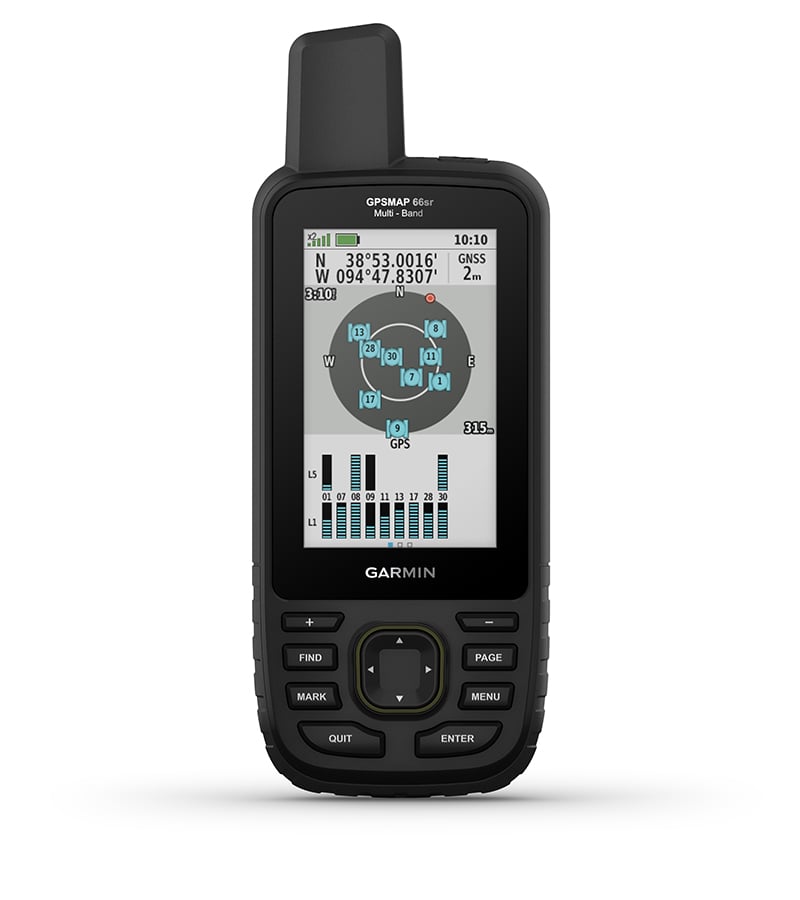
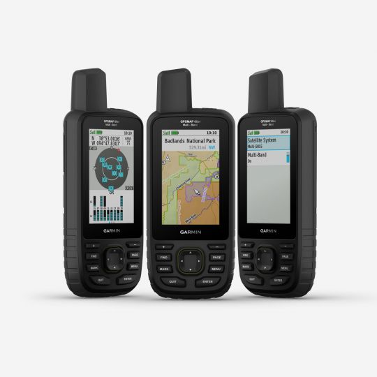
EXPANDED GNSS SUPPORT
Multi-band technology and expanded GNSS support (GPS, GLONASS, Galileo, QZSS and IRNSS) provide optimal accuracy in steep country, urban canyons and forests with dense trees.
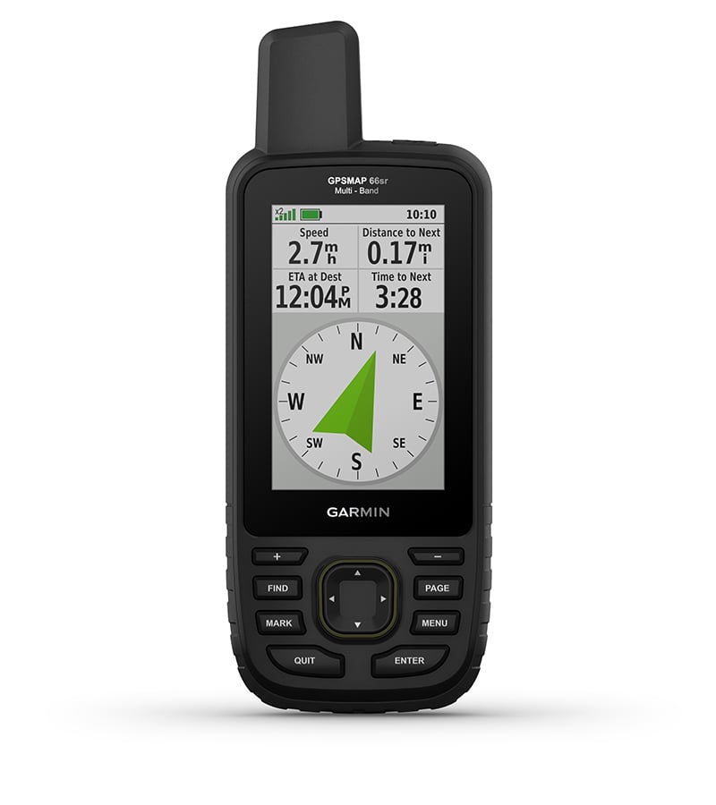
ABC SENSORS
Navigate every trail with ABC sensors, including an altimeter for elevation data, barometer to monitor weather and 3-axis electronic compass.
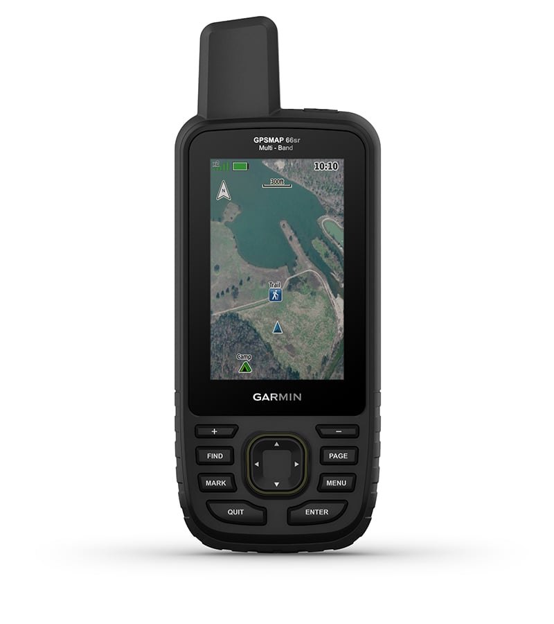
BIRDSEYE SATELLITE IMAGERY
Download high-resolution photo-realistic maps directly to your device without an annual subscription. Easily find trails, pick stand locations, find parking, create waypoints and more.
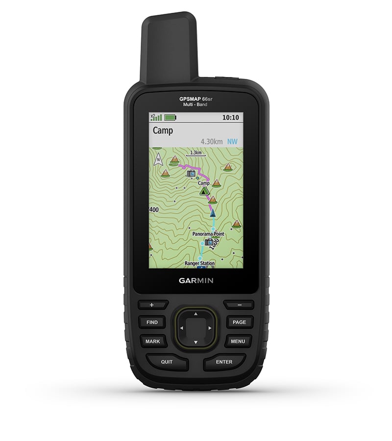
PRELOADED TOPO MAPS
Preloaded TopoActive U.S. and Canada maps show you terrain contours, topographic elevations, summits, parks, coastlines, rivers, lakes and geographical points.
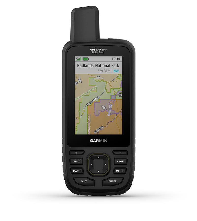
PUBLIC LAND BOUNDARIES
Optional display of federal public land boundaries on topographical maps helps you know that you’re venturing where you’re supposed to be.
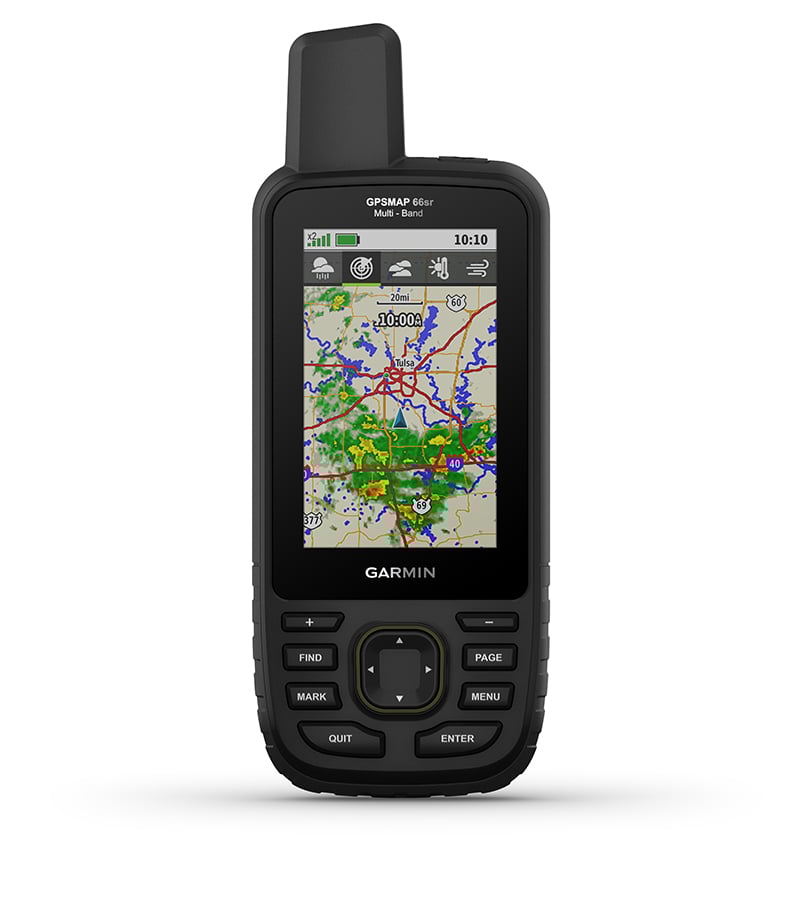
ACTIVE WEATHER
When paired with your compatible smartphone, you can get real-time forecast information and live weather radar, so you’re aware of the surrounding conditions1.
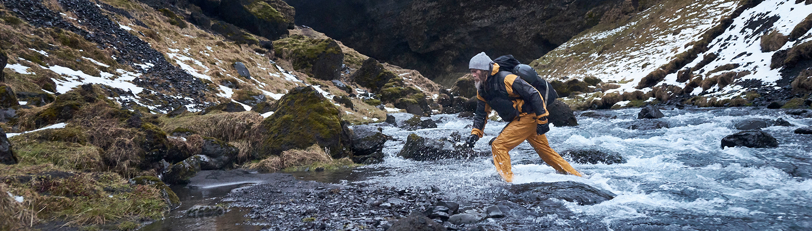
Be adventure ready.
BUILT FOR ADVENTURE
This handheld is built to military standards for thermal, shock and water performance (MIL-STD-810), and it’s even compatible with night vision goggles.
LED FLASHLIGHT
The GPSMAP 66 series helps you keep gear to a minimum with a built-in LED flashlight that can be used as a beacon to signal for help.
GEOCACHING
Get automatic cache updates from Geocaching Live, including descriptions, logs and hints. When connected via Wi-Fi® technology or to the Garmin Connect™ app2, each find will upload to your Geocaching.com profile.
GARMIN EXPLORE™ APP
Plan, review and sync waypoints, routes and tracks by using the Garmin Explore™ app2 and website. You can even review completed activities while still in the field.
BATTERY LIFE
Internal Lithium-ion rechargeable battery provides up to 36 hours of battery life in GPS mode and up to 3 weeks in Expedition mode.
The information below is required for social login
Create New Account